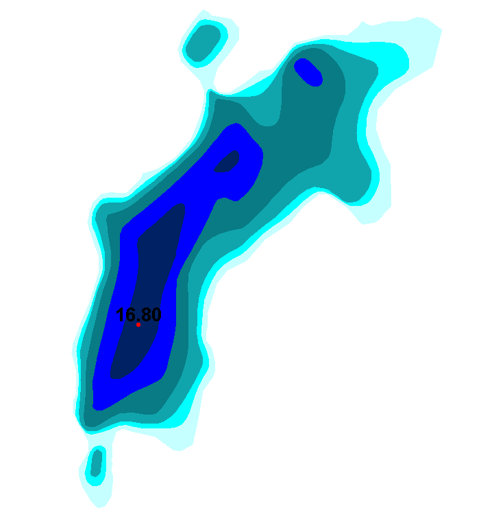
Järvien ja jokien syvyysaineisto
Sisävesien (järvet, joet) syvyysaineisto perustuu pääosin ympäristöhallinnon tekemiin syvyysluotauksiin. Luotauspisteaineistosta on Sykessä johdettu syvyyskäyrät ja -alueet sekä järven maksimisyvyyspiste- aineistot. Järvien luotaus- ja maksimisyvyyspisteisiin sekä syvyysalueisiin on yhdistetty fysiografiatietoja Syken ylläpitämästä järvirekisteristä. Nämä syvyyskäyrät toimitetaan Maanmittauslaitokseen, jossa ne tallennetaan osaksi maastotietokantaa ja edelleen julkaistaan maastokartoista. Aineisto kuuluu SYKEn avoimiin aineistoihin (CC BY 4.0).
Aineistosta on julkaistu INSPIRE-tietotuote.
Lisätietoja:
https://geoportal.ymparisto.fi/meta/julkinen/dokumentit/Syvyys.pdf
The Lake and River Depth Profiles dataset includes information on depth profiles of lakes and rivers and is mainly based on the depth measurements done by the national environmental administration. The bathymetric lines and the depth areas are produced from separate measurement point information. Bathymetric information and the maximum depth points have also information on physiography from the lake database “Järvirekisteri” maintained by Syke. These bathymetric lines are delivered for The National Land Survey of Finland where they are combined with the base map dataset (Maastotietokanta) and published as maps.
Simple
- Date (Revision)
- 2016-09-13
- Unique resource identifier
- http://paikkatiedot.fi/so/1002010/el/ContourLine
-
SYKE resource classification
-
-
Paikkatietoaineisto
-
- Keywords
-
-
INSPIRE-tietotuote
-
-
High-value dataset categories
-
-
Maan havainnointi ja ympäristö
-
-
EU legislation
-
-
Arvokkaat tietoaineistot
-
INSPIRE
-
- Use constraints
- Other restrictions
- Other constraints
-
Creative Commons Nimeä 4.0 Kansainvälinen http://www.syke.fi/fi-FI/Avoin_tieto/Kayttolupa_ja_vastuut
Lähde: Syke
- Access constraints
- Other restrictions
- Other constraints
- no limitations
- Spatial representation type
- Vector
- Denominator
- 10000
- Metadata language
- Finnish
- Topic category
-
- Elevation
))
- Distribution format
-
-
ESRI Shape
(
3.x
)
-
GML
(
3.2.1
)
- Specification
-
D2.8.II.1 Data Specification on Elevation – Technical Guidelines
-
OGC WMS
(
1.3.0
)
-
OGC WFS
(
2.0.0.
)
-
ESRI Shape
(
3.x
)
- OnLine resource
- Syken Avoin tieto -palvelu
- OnLine resource
- Syken Avoin tieto -palvelu
- OnLine resource
- Syken INSPIRE ATOM-syöte
- OnLine resource
- Korkeus INSPIRE WMS-katselupalvelu
- OnLine resource
- Korkeus WFS-latauspalvelu
- Hierarchy level
- Dataset
Conformance result
- Date (Publication)
- 2010-12-08
- Explanation
-
Tietotuotemäärittelyt Inspire-direktiivin mukaisten paikkatietotuotteiden osalta.
- Pass
- Yes
- Statement
-
Sisävesien (järvet, joet) syvyysaineisto perustuu pääosin ympäristöhallinnon tekemiin syvyysluotauksiin. Luotauspisteaineistosta on Syke:ssa johdettu syvyyskäyrät ja -alueet sekä järven maksimisyvyyspiste. Lammin Pääjärven osalta lähtöaineistona on käytetty Lammin biologisen aseman tuottamaa syvyyskarttaa. Aineiston tuotanto on aloitettu 1998. Vuosittain yleensä syksyisin aineiston täydentyy edellisen vuoden kesänä luodattujen alueiden osalta.
- File identifier
- {DC4AD1E9-F4E5-4998-825D-D2CA4836A2F5} XML
- Metadata language
- Finnish
- Character set
- UTF8
- Hierarchy level
- Dataset
- Date stamp
- 2024-05-20
- Metadata standard name
-
ISO 19115
- Metadata standard version
-
2003/Cor.1:2006
Overviews

Spatial extent
))
Provided by

 Paikkatietohakemisto